Showing posts with label #Alberta. Show all posts

Wednesday, March 25, 2026

A Travel Writer Again


I took a few writing courses and began my published, writing career (as opposed to my unpublished writing career) with a short story titled A Hawk's Reluctant Flight, in a small magazine called Western People. With that on my short resume, I had travel and historical articles accepted by other magazines, one of which didn't pay anything to the author. Then I took another writing course and one of the speakers was a publisher, Grant.

At the time Alberta was divided into tourist zones and I had been thinking about doing a book on what there was to see and do in each zone. I sent a query letter to Grant's publishing company and the senior editor responded with a phone call. We set up a time for me to go to the city and meet with both of them. I outlined my idea and Grant said yes it was a good one but he thought the books should be more on the people and culture of each zone. He liked his idea and I liked mine so we decided we couldn't work together. As I stood to leave I said. "Well, at least as I research the zones I will see all the backroads of Alberta." He replied. "I've always want to do a book on the backroads of Alberta." I sat back down and that was how I began my backroads series. Over the next ten years I travelled through and wrote two travel books on Alberta, four travel books on British Columbia, and one travel book on the Yukon and Alaska.

My favourite books to read have always been mystery novels and after much thought I decided to write one. Since one of the mantras of writing is to write what you know I made my main character a travel writer. Since then, I have written seven mystery, six historical, two sci/fi, two holiday romance/comedies, and one non-fiction. And now, thirty-three years after my first Alberta travel book was published, I am a travel writer once again.

My latest book is titled 'Roadtripping Southern Alberta' and here is the Introduction, and the section of the book that explains the front cover. Enjoy reading and hopefully you will visit the area soon.

Introduction

 Unfortunately, many people have lost the art of the drive. It’s been replaced by the art of the destination. Everyone wants to get to their journey’s end instead of enjoying the drive, the travel. This book is about travelling through southern Alberta. Each chapter in this book is a loop, so you start and end in the same place. Some of the loops are close enough to each other that you can hop off one and onto another, tour it, and then hop back onto your first loop. You are free to take as long as you wish on each chapter to enjoy the whole experience.

Most hamlets, villages, and towns have museums that are preserving and chronicling the unique history in each area. After visiting those, and other places cited in this book, drive or walk around the communities. You might see children selling lemonade or iced tea on a street corner or you might meet the residents who are friendly and helpful. You can check out the shops, galleries, and stores. There is always something unique and interesting to see. Plus, you might be fortunate enough to find a Farmer’s Market where you can pick up fresh vegetables, baking, eggs, and meat products.

Regrettably, not all sites, adventures, or experiences are mentioned here- it would take a book much larger than this and I extend my apologies to those places. This book is designed to give you an idea of the natural and man-made attractions, the stories and history of the areas, and the famous and infamous people who lived here. In the process, it is my aim to get you out exploring this part of the province. So, if you see a sign for something not mentioned in here, or if you wonder what is down a road, feel free to go check them out. It is your holiday and hopefully this book will make you love the journey again.

Alberta is a large province with wide, open spaces. In places you have an unobstructed view in all directions. Sometimes there is a long distance between towns or locations so you can check to see how the crops are doing, count the number of cattle in a field, watch for wildlife, and wonder about the dreams of the people who built the houses, barns, and granaries that are now in various stages of decline. Or you can play a new game: I spy with my little eye in the far, far distance something that is….

It doesn’t matter how you are travelling, there are campgrounds (some with hook-ups, some primitive), resorts, national and provincial parks, recreation sites, hotels, B&B’s, and motels for you to stay at. Most towns have parks for picnics and golf courses, and some have RV sanitation dump stations.

If you decide to reverse the route in which you explore any of these roads, remember to also reverse the direction in which you turn off that road. Once off the road, all other turns will remain the same.

Relax and enjoy the trip and remember, many of the sites you will see can only be found in this province. As one man I met said: "This is the true Alberta."

Medicine Hat and Red Rock Coulee

‘The city with all hell for a basement’ was the way Rudyard Kipling described Medicine Hat because of the gas fields discovered beneath it in the 1880s. By the early 1900s most homes, offices, schools, and churches were heated by the gas.

The city was named after the Saamis, or Medicine Man's, hat which was lost by the Cree's medicine man during a battle with the Blackfoot. This was considered a bad sign and when the Cree were all killed the site was given the name Saamis.


The Saamis Tepee, which can be seen from the Highway as you drive through the city, was originally constructed for the 1988 Olympics in Calgary. After the Olympics, it was bought, dismantled, and moved to Medicine Hat where it overlooks the Seven Persons Creek Coulee. The teepee is 20 storeys or 65.5 metres high and its poles are made of steel with a concrete foundation.

To see the teepee, exit off the highway onto Southridge Drive/College Avenue SE and the teepee plus the Medicine Hat visitor information centre are to your right along Southridge Drive. At the centre you will find information on sights not mentioned here such as the city's historic walking tour, the viewpoints, and the many parks.

The poles of the teepee are not covered so it is open to the sky. Walk inside the teepee to see the round storyboards, which are paintings depicting stories about the history of the first people, such as the Plains Cree, the Blackfoot Confederacy, the arrival of the non‑First Nations, and the Metis. There are interpretive signs below explaining each board.

From the teepee you can walk to the edge of the cliff and look down on the Saamis Archaeological site in the Seven Persons’ Coulee below. It is believed that the area was occupied as far back as A.D. 1525 and as recently as A.D. 1740.

With the abundance of clay along the banks of the South Saskatchewan River in the Medicine Hat area, it was natural that a pottery industry began and grew in the early 1900s. There was natural gas to fire the kilns and a railway to transport the finished products to market. Three potteries, Medalta, Medicine Hat, and Alberta, were all operating at the same time. Medicine Hat Potteries later became the Hycroft China, Ltd.

To see the products of Medalta Potteries and to take a tour of the building, museum, and huge kilns at 713 Medalta Avenue SE, turn left onto Southridge Drive when you come out of tourist information. Southridge Drive becomes College Avenue when you cross Highway 1. You reach a four‑way stop at Kipling where you go right. Head straight through the lights at Dunsmore and when you come to Allowance Avenue turn left. You cross the railway tracks on an overpass and just after the tracks is Prince Avenue where you again go left. Head one block to North Railway Street and bear left once more. You have the railway tracks to your right as you drive and then turn right on Highway 41A east. At Wood Street you turn right and in one block is the Medalta Potteries. There are signs to follow to make these directions easier.

The building now houses an industrial museum and art gallery. Tours and workshops are offered and once you have finished your tour, visit the large gift shop which sells all their pottery.

As you leave Medicine Hat going west, get onto Highway 3. At the west end of the city you will pass Holsom Road which leads to Echo Dale Park. In 20 km from Holsom Road turn left on SH 887S to go to the Red Rock Natural Area also called Red Rock Coulee. The road is paved and at km 24.7 from the highway it curves to your left. However, you continue 1.8 km ahead on the gravel road to the small parking area on the right. After walking through the gate, stand and look at the large masses of stone in the coulee. You will be intrigued by the huge, red or reddish-brown rocks that are shaped like gigantic balls with flat tops. These are called concretions and are scattered over a wide field. Many of them have been split in two or more pieces by the elements. While they seem to have been randomly thrown in the coulee, they are actually finely layered, red sandstone boulders emerging, through erosion, from the softer ground around them.


They were formed over 74 million years ago in a shallow sea which covered the area. The reddish color is from hydrous iron oxide or rust.

Just remember as you wander through the rocks that you are in rattlesnake country. And because the soil content is comprised of bentonite (volcanic ash) and clay, which, when mixed with water, forms gumbo (smectite), if it starts to rain get out of the field as quickly as possible. You could sink in the soil up to 8 cm or even slip and fall on the gel‑like surface.

Back on Highway 3 and heading west, you will reach Bow Island in 35 kms. 


Wednesday, September 21, 2022

Alberta History in My Writing


https://www.bookswelove.com/donaldson-yarmey-joan/

I began my writing career as a travel writer and I drove and camped through all of Alberta, British Columbia, and the Yukon and Alaska, writing about what there was to see and do in those provinces, and the territory and state. I learned a lot of history, saw a lot of beautiful scenery, and met a lot of wonderful people.

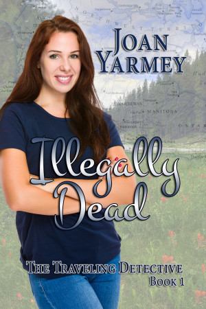
The following historical excerpt is about Fort Macleod, along the Crowsnest Highway, from my travel book the Backroads of Southern Alberta. Fort Macleod, coincidently, is the setting for the novel, Illegally Dead, the first book of my Travelling Detective Series.

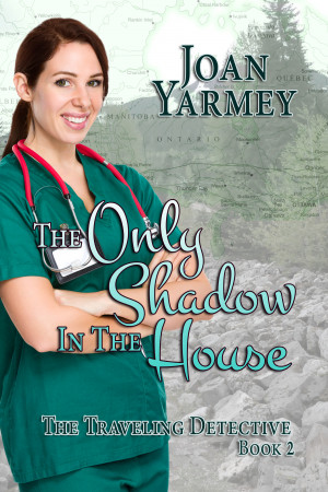
The Only Shadow in the House is set north and east of Edmonton, Alberta, and Whistler’s Murder takes place in Whistler, British Columbia.

After the Hudson's Bay Company sold Rupert's Land to the Canadian Government in 1869, fur traders from Fort Benton in Montana travelled north into present day Alberta and set up illegally trading posts called Whiskey Forts. They brought wagon loads of whiskey and guns to trade for furs with the natives. The watered down whiskey, laced with any or all of Tabasco, red pepper, tobacco, ginger, molasses, tea, sulphuric acid and ink, drove the natives wild and they brutalized and killed their own tribesmen, other bands, and some whitemen. Sir John A Macdonald, prime minister of Canada at the time declared that the area should be safe for settlers moving west and he formed the North West Mounted Police (NWMP) in 1874. They marched west and established Fort Macleod, which is southern Alberta's oldest settlement.

The downtown district, on 24th Street between Second and Third Avenues, was declared Alberta's first provincial historical site on May 14, 1984. There are many wood frame buildings that date back to 1890s and some brick and sandstone ones from the early 1900s.
The Empress Theatre opened in 1912 and was used for vaudeville acts, minstrel shows, silent films, political rallies and talking films. It has been renovated, but the original pressed metal ceiling, double seats in every second row, and the old radiators remain. The Empress Theatre Society presents movies or live performances during the summer.
The present-day Fort Macleod is a reproduction, but some of the log buildings inside the Fort Museum are original and house numerous historical native and North West Mounted Police-Royal Canadian Mounted Police artifacts. A Musical Ride is staged four times a day during July and August. Young men and women dressed in replica North West Mounted Police uniforms present an exhibition of horsemanship and precision, similar to the world famous Musical Ride.

Harry `Kanouse' Taylor, a former whiskey fort owner, set up a hotel in Fort Macleod after the arrival of the NWMP-the original name of the RCMP. Due to the changing times and transient population, there had to be certain rules in his hotel. They were:
1. Guests will be provided with breakfast and dinner,
but must rustle their own lunch.
2. Spiked boots and spurs must be removed at night
before retiring.
3. Dogs are not allowed in bunks, but may sleep
underneath.
4. Towels are changed weekly; insect powder is for sale
at the bar.
5. Special rates for Gospel Grinders and the gambling
profession.
6. The bar will be open day and night. Every known fluid,
except water, for sale. No mixed drinks will be served
except in case of a death in the family. Only
registered guests allowed the privileges of sleeping
on the bar room floor.
7. No kicking regarding the food. Those who do not like
the provender will be put out. When guests find
themselves or their baggage thrown over the fence,
they may consider they have received notice to leave.
8. Baths furnished free down at the river, but bathers
must provide their own soap and towels.
9. Valuables will not be locked in the hotel safe, as
the hotel possesses no such ornament.
10. Guests are expected to rise at 6:00 a.m., as the
sheets are needed for tablecloths.
11. To attract the attention of waiters, shoot through
the door panel. Two shots for ice water, three for
a new deck of cards.
No Jawbone. In God We Trust; All Others Pay Cash.

Monday, November 1, 2021

Daytripping from Edmonton

https://www.bookswelove.com/donaldson-yarmey-joan/


Gibbons, St Paul, Andrew Loop
 

Take Highway 28A out of north east Edmonton and follow it to Gibbons. On the corner of 28A and 50th Avenue in the town is the Emmanuel Anglican Church. The interior, with its U-joint style and large beams, is modelled after the inside of a ship and is unique in Alberta. It was constructed in 1902 and is still in use today.
The Sturgeon River Historical Museum is in Oliver Park on 48th Avenue. McLeans Store has a counter with an antique cash register, shelving full of boxes and cans, books, photographs, desks and an old sewing machine sitting on a hardwood floor. A log building with artifacts from the area and a small home with 1920s furnishings are two of the other buildings on the grounds.
At the opposite end of town is Echo Glen Park. The park is beside the Sturgeon River and there is a hiking/biking trail that will take you along the high banks of the river.
Continue past the park to reach a stop sign on Highway 28. Turn right and head to Redwater.
One of Alberta's major oilfields was discovered near Redwater in 1948. To commemorate the oil industry the town has preserved the Discovery Derrick which was used to drill the first well. The derrick, which at 51.2 metres high is said to be the tallest oil derrick in North America, is in a park on 53rd Street.
Follow 48th Avenue out of town to the junction with Highway 38 where you go right. Turn left at the Victoria Trail sign to head towards Fort Victoria itself. The road is fifty-eight kilometres long and mainly gravel, and although is doesn’t exactly follow the route since some of it has been plowed under, it uses as much of the original trail as possible. The Victoria Trail was part of an overland route from Fort Garry (Winnipeg) to Edmonton dating from the 1820s and called various names such as the Carlton trail, Winnipeg Trail, Fort Pitt and Saskatchewan Trail depending on the section referred to. Victoria Trail is that part between Edmonton and Fort Victoria.
There are signs along the road so don't let the number of twists and turns stop you from taking this enjoyable drive along a trail that natives once walked and, beginning in the 1820s, early settlers travelled in Red River carts. They would probably be surprised at the changes along it: the large, modern homes, the big barns, the rows of metal granaries, the machine sheds with their full line of farming machinery, the open fields of grain, and the animals. The biting smell from the barn yards would certainly be unlike the sweet smell of flowers, trees, and open air to which they were accustomed.
The road winds through farmland and beside farm houses and old buildings. You will come to the original site of the Jack Pine Grove School PSD No. 2051, which operated from 1910 to 1951. Just past that is a cairn for Jack Pine Grove School District No 2051, Eldorena, founded in 1909. The church behind the cairn is the Eldorena Ukrainian Catholic Church built in 1912.
As you continue driving watch for the valley to your right and the banks of the North Saskatchewan River. At one point the road is like a country lane with trees lining it. But it is also narrow and winding with blind corners so keep to your side of the road. At about the half way point you reach Highway 31. It goes to Waskatenau if you wish to get off the gravel road. Proceeding ahead watch for the road to the left that goes to the church and cemetery of the former Lobstick Settlement.
Return to the Victoria Trail and soon you will come to the RCMP Memorial Sculpture. The thick, plate steel statue of an RCMP officer astride a horse sits on a base made of rock. Names like S.B. (Sam) Steele #1, P. Coutts #95, Sub-Inspector S. Gagnon, R.E. Steele #7 are painted on some of the rocks. These are the names and rank or regimental number of the twenty members of the newly founded NWMP who left the main group on July 29, 1874 and headed to Fort Edmonton, passing along this trail in October of that year. The cairn was erected on August 4, 1998.
There are two sharp curves after cairn and then a dangerous curve, with an old house to the left, so proceed with caution. When you reach SH 855, the road to Smoky Lake, continue across and you will be on pavement heading to the Victoria Settlement. Here there are two cemeteries, the Pakan Church constructed in 1906, and the clerk’s quarters built by the Hudson Bay Company in 1864. The quarters is said to be Alberta's oldest structure still on its original foundation. It has been restored and on the inside walls you can see where the Hudson Bay employees carved their initials.
Stroll along the asphalt paths under the spreading branches of the tall maples planted during the early years of the post. If you brought a lunch have a picnic at a table on the large lawn. Or grab your fishing gear and hike down the wide path to the North Saskatchewan River. You can fish from the banks where the fur traders landed their canoes over one hundred years ago.
In Smoky Lake the old CN station, on West Railway Drive, is now a museum. Inside are photographs and posters on the wall, an old telephone and telegraph, the original desk, and the old wood stove.
The town of Smoky Lake was named for the nearby lake which was initially called Smoking Lake by the Cree. In one version of how the lake received it name, the aboriginal people, who stopped by its shores to smoked their pipes during their hunts, called it Smoking Place. In the other story, it was selected because the mist lifting off the lake resembled rising smoke.
Smoky Lake bills itself as the Pumpkin Capital of Alberta. This is because the town holds the Great Pumpkin Fair and Weigh Off on the first Saturday in October. Prizes are given for the largest, the ugliest, and the best looking pumpkin.
Drive into Vilna to see what are claimed to be the world's largest mushrooms in a little park. They are six metres high and are from the Tricholoma family. They are called uspale mushroom which is a traditional mushroom used in Ukrainian cooking in the area. The mushrooms were erected in August, 1993.
Glendon bills itself as the Pyrogy Capital of Alberta. You drive into town on Perogy Drive and in Perogy Park is a giant perogy, said to be the largest in the world. The pyrogy, which is held up by a fork, is over seven metres in height.
The pyrogy was unveiled on August 31, 1991 to coincide with the beginning of the 1992 nation-wide celebrations commemorating the 100th anniversary of Ukrainian settlement in Canada. If you want a sample of the Ukrainian fare, visit the Perogy House across from the park.
As you drive into St. Paul watch for unidentified flying objects hovering overhead, waiting for an opportunity to land on the world's first man-made UFO landing pad. The circular platform, with provincial and territorial flags flying overhead, waits patiently for its first UFO landing on the corner of Galaxy Way. It was erected as a centennial project in 1967 and a time capsule inside the pad is to be opened in 2067.
The land beneath the landing pad has been designated international by the town of St. Paul. Climb the steps onto the UFO pad and walk across the pedway to the visitor information building which has been designed to resemble a UFO. Inside you will see an interpretive display complete with photographs of UFOs and crop circles, and write-ups on the different hoaxes that have been pulled. The town operates a UFO hotline with the number to call being 1-888-SEE-UFOS.
As you enter Elk Point, on your right is a statue of Peter Fidler in the Peter Fidler Peace Park. This park was officially dedicated in 1992, Canada's 125th anniversary of confederation, as part of the Peace Parks Across Canada project.
Fidler joined the Hudson Bay Company when he was nineteen and studied surveying. In 1792, he helped build Buckingham House and became its Factor five years later. He then travelled throughout the west constructing other fur trading posts.
As you leave Elk Point follow the signs to Fort George and Buckingham House. At the parking lot you will find an interpretive centre with replicas of voyageurs, buffalo, teepees, and a gift shop. There is also a map showing the layout of the forts. A short interpretive trail takes you to the sites of Fort George, constructed by the North West Company in 1792 and Buckingham House, built later that same year. Both were fur trading and provision posts providing pemmican for the canoe and York boat brigades.
They were situated on a plateau overlooking the North Saskatchewan River and the fur traders had the difficult task of hauling their supplies up the hill from their canoes. The posts did, however, have a beautiful view of the river valley.
Follow the scenic highway to Two Hills and check out their museum on the corner of 51st Street and 52nd Avenue. In Willingdon is the Willingdon Tourist Park with a campground, picnic tables, and a mural on a huge rock. At the end of town is SH 857 which will take you north to the Historical Village and Pioneer Museum at Shandro. A few of the more than twenty buildings to tour are a blacksmith shop, a post office, a funeral home, and a reproduction of a sod house, all of which are furnished appropriately. You will also see the ferry used on the North Saskatchewan River north of the museum before the Shandro Bridge was constructed.
In Andrew is a small park. Besides a caboose, a playground, mini golf, and tennis courts there is a statue of a giant duck. The colourful Mallard duck was chosen as a symbol for the village of Andrew and this replica was erected on April 29, 1992. It is said to be the largest Mallard in the world.
On the corner of Highway 45 and SH831 is the Skaro Shrine. The shrine was designed as a replica of the Grotto of Lourdes in France and constructed in 1919 by local residents. The first pilgrimage was held on August 14, 1919.
And this ends your journey for today.